
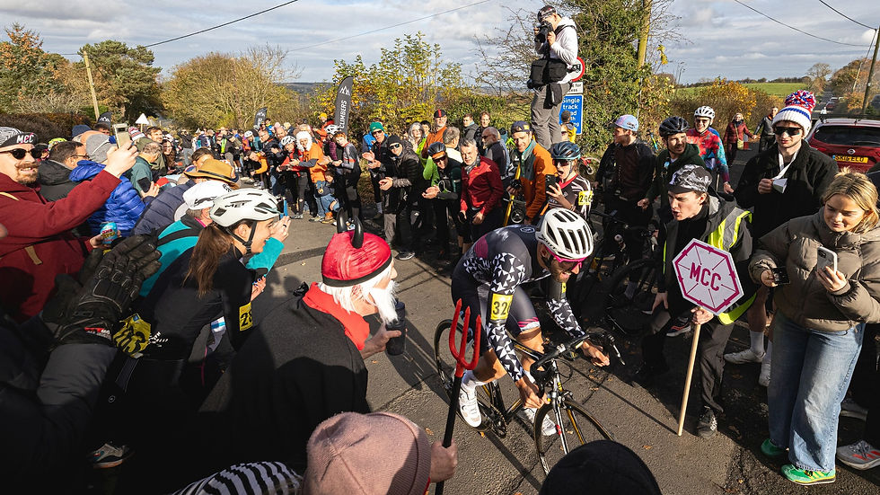
The Ultimate c2c2c - Everesting 10k Roam
- Joe Stringer

- Jun 22, 2021
- 22 min read
The first whiff I caught of this Muckle ride was when I looked at Strava on Saturday and saw that Ben W had done a rep of GDF at around 03:00. You just knew that something ridiculous was going down. All i could do was smile, shake my head, and wait to find out what had been cooking, at the same time as resigning myself to kissing goodbye to any notion of winning 'Muckle Ride of The Year' for the 3rd year running. Anyway - here's a report of the ride from Simon Douglass. I'm happy that he's revealed the true reason behind my achilles injury as well, so people can stop giving me stick for going out for the odd jog now and then. Over to you Simon...

I did a bike ride with @SimonWalker and self indulgently wrote about it. Take it or leave it!
You have to dream big if you want to even put in a worthwhile entry for a ride of the year in Muckle Cycle Club. Nobbling the Stinger's achillies was phase 1 but this lunacy was phase 2 (and still, who knows what is going to trump it this time?!). In the end it was 3 years in the planning and it felt like almost as long in the execution. Obviously the Walkers (Ben and Simon) needed to be talked into it, not that it was that hard, but the company is all the more important on this kind of escapade so I owe everything to them both (apart from the original idea and the route - that was all on me). The headlines are: We did it and probably won’t again. This record is as much for me when I’m old(er) as anything so if all you want is the result then you can stop reading now - but if you want the gory details they are included in rambling fashion below. Unlike a traditional Everesting where you ride up and down a single climb until you've ascended the height of Everest (8848m / 29031ft), an Everesting 10k involves any single ride which includes 10k elevation. Now this sounds simple and in fact most of the Everesting 10k rides in the hall of Fame (Everesting.cc/hall-of-fame/) are merely extensions of traditional Everestings - I say merely because once you've done a climb for a whole day (I'm talking normal humans not your Ronan McLaughlins here) a few extra reps isn't going to make a great deal of difference - I certainly felt I could have continued for another 5 or 6 reps of Prospect Hill in 2019 if someone had been holding a gun to my head...... Anyway I digress. The Everesting 10k is another logistical level all together, at least in the North of England. The problem isn't the climbs, as there are plenty of those, it's how you add them together in a fun(!) and creative way to get to 10k elevation without having to ride forever. I somewhat failed on this point, I think. Having never done a c2c2c ride I thought the solution may be to add the two challenges together and go from North Sea to Irish Sea and back while ticking off 10k elevation. This provided a broad basis for the route and then it was just adding in enough climbs to generate the elevation. In the North East we have many, many great climbs, so it was more about what to leave out, Pennines followed by Lakes and then Pennines again would do it. The moment of inspiration was adding Great Dun Fell. This is one of my favourite UK climbs (7.3km, 620m, 8.5%), which has the added benefit of being a closed road so there is usually no traffic at all. It's basically a service road to an air traffic control radar on top of the Pennines so it has amazing views both east and west. It seemed an ideal place to watch the sunrise from in the east so it started to be the hook round which to hang the rest of the ride - the key question - What time do we need to leave Gateshead to get to GDF for sunrise? Ah the timing question. Usually when you plan a long ride it's based on how many hours of daylight there are, how many miles can you squeeze in and then how much elevation- last year's 200 miler in the Yorkshire Dales (from Gateshead) with around 5000m elevation was a good yardstick so it was clear that this ride would involve some riding in darkness. The other issue was just how much the effect on the body would be after a) no sleep and b) huge energy expenditure so I started to look at basing the plans around an average speed of 22km/h rather than the usual 25km/h for this kind of hilly ride as a way of carrying through enough energy to complete …rather than the usual methodology of "full gas" as far as possible. Even without breaks this accounted for 24 hours of riding time so it started to look like a pretty substantial undertaking of over 28 hours or so. Based on nothing so much as trying to visualise how it would feel to ride through the night I decided that the ride needed to be started one day to finish the next and be relatively fresh for the part of the ride during the night (which was as short as possible due to the time of year). Then by counting back to the timing of sunrise in the Pennines I settled on a starting time of 7.30pm to allow a gentle (ish) night ride of 100 miles to the summit of GDF for sunrise. You obviously don't set off for a ride like this on a whim and it does take some planning and training the body to get used to endurance. So from March this year we had been doing regular 100s with 150s and a 200 thrown in with decent elevation counts too. Ben was struggling a little with a leg problem and felt he hadn’t done quite enough longer rides to manage this one but Simon was persuadable so we decided to do a 2 man version with Ben kindly offering support via a borrowed van. In retrospect I don’t think this would have been possible without support. At the appointed start time, Ben turned up in the van and we loaded a vast amount of gear in: spare clothing, wheelsets, food for a month, lights (more later), water, lucozade, chocolate. My shopping strategy for this kind of things is totally unscientific, just but a load of the usual crap I would love to east while pissed on a Saturday night - probably not a British Cycling approved performance enhancing technique but at least legal. We started riding on the Friday night at 7.30pm, which was pretty much the exact time the England v Scotland match at Euro 2020 kicked off. The first couple of hours were ridden through a post-apocalyptic landscape devoid of humanity, except where the occasional gaggle of smokers spilled out of pubs showing the match. While it was already surreal starting a ride at that time this made it even stranger!

The plan was to carry fairly minimal amounts of stuff, water, a few bars and enough tools to manage and then meet up with Ben in the van every hour or so to replenish supplies. This broke things up nicely. We started in Gateshead and quickly headed out to Fausto in Sunderland for an obligatory picture and quickly rode over to Langley park where Ben was waiting to stock up. Heading to Wolsingham we started to need lights and the descent into Wolsingham down Red bank was a first introduction to how different it feels to descend a road you know has a pretty ropey surface at speed in the dark (more later on this too).
A quick blast along the main road to Stanhope was uneventful - this was one of the bits I had been dreading during planning, I thought on a Friday night there may have been a load of drivers not being very careful or appreciative of cyclists (and judging by the piles of nitrous oxide cartridges in laybys that I see round there possibly not entirely in control of their vehicles either). Then it was up Unthank Bank (2.99km, 186m, 6.2%) and Bollihope Common (2.89km, 223m, 5.7%) with a steep and winding descent in between which was negotiated safely, watched by munching sheep on either side of the road. You start to get attuned to the danger of a suicidal sheep, or more usually a lamb, making a dash across the road in terror, thankfully no near misses this time although Simon had a very near miss with a little bunny at one point...and also a hit...murderer!!
Next stop was Middleton-in-Teessdale and the roads really were eerily quiet, not that we were complaining. A slightly longer than expected break, some chamois cream reapplication (Ben refused to fulfil his contractual soigneur duties at this point!!), restock of water and bars and then heading back into the hills towards Brough (Brough Hill, 13.2km, 195m 1.5%). This is one of my favourite pieces of road, wild and desolate and a really long, steady ascent before a final kick up to the watershed with Cumbria and a fast descent (in normal circumstances) to Brough. At one point there was an eery set of headlights in the mist in the distance as Ben turned the van round - like a scene from Close Encounters (ask your mum and dad). I know this descent pretty well (down Shot Moss) but it was very different in the dark especially as it's not the best road surface, but we made it safely into Brough for another refuelling stop.
Did I mention the need to pee? I'm poor at rehydration on the bike to the extent that in winter I sometimes come back from a big ride with an almost full water bottle so it was important to remember to drink. The unexpected side effect of which was pissing like a horse - in retrospect this more than anything made have impeded the progress towards the middle and end of the ride. Simon was finding something similar too.
Brough is probably unused to cyclists reapplying chamois cream in the main street at 1am but the resident taking photographs - presumably to make a later complaint about cyclists publicly eating cold pizza and refilling water bottles in the middle of the night - was probably overkill.
Next was a run through to the bottom of Great Dun Fell. Ben drove through to meet us there and prep his bike as he was riding up too. It took longer than expected as the roads were all very narrow and in poor condition so we kept it cautious and eventually passed through a deserted Appleby in Westmoreland, arriving at the bottom of GDF just behind schedule at about 3am. The sky had never been really dark and although it was a bit cloudy you could already see a spectacular sunrise brewing in the east.
With Ben leading we headed up Gdf (7.3km, 620m, 8.5%) in a decent time for the circumstances. The 8.5% average never really does this climb justice as there is some downhill and a couple of flatter sections but there are sustained sections of around 20% which are pretty hard with 100miles in the legs. I'd tried to find a sustainable pace for this climb earlier in the year and we aimed for a time of around 43 mins - we were pretty much spot on with this. When we arrived at the golf ball the sun was really lightening the sky and we could see the valleys full of cloud or fog, especially over towards High Cup Nick, and it developed into a truly amazing sunrise. We took a few pictures and headed back down in the gathering daylight, already the descents feeling easier with extra light. As usual on this descent I stopped for a bit to let my superheated carbon wheels cool down (a legacy of the time I was filming a clubmate on my gopro and melted my wheels.... expensive mistake).

Next it was on to Tebay via the beautiful Hoff Lunn (6.72km, 177m, 2.6%) with some steep bits but long and fast descents and unusual signs for "cows on road"! Ending with a descent down into Orton, a charming little village and a hop over to Tebay for another refuelling stop. This is where things start to get serious, day getting brighter, increasing traffic, 130 miles down… As motorways go the M6 south of Tebay is nothing short of beautiful. In fact I recall mentioning to Simon that this was my favourite bit of motorway in the UK – yes the patter was already deteriorating but it was to get a lot worse… we rode along parallel to the M6 climbing up the side of the valley and turning right into the Lake District for the first time over the Fell Poets (0.6km, 58m, 9.2%). This is to the South of the Lakes where they flatten off towards Morecambe Bay so you can look south west and see Heysham nuclear power station and north west and see the Southern Lakes fells. Next was a westerly trek parallel to and around the A6 toward Staveley to link up with the road to Kirkstone Pass. This was via the uncategorised (in my version of the road book…!) climb of Misket Brow (1.88km, 85m, 4.3% - none of these figures seem to do climbs proper justice!) and down to join the road to Kirkstone Pass. I’d once climbed this side of Kirkstone Pass on the Fred Whitton so I knew it was the easier side and it was a pleasant ascent to the Kirkstone Inn (6.3km, 330m, 5.12%) at the top of which Ben was waiting with the supplies. On the day of the Fred this was filled with people who had gone off to hard (it was the first climb I think) and blown up but this time we kept it steady and, feeling pretty good, headed down the descent of the Struggle to Ambleside. It says nothing in particular really that given the option I would rather do 10 climbs of this road than 10 descents. Steep, fast, winding, busy traffic, stone walls close on either side and sheep everywhere – including a full herd with at least 12 sheepdogs keeping them honest – not my favourite (although unlike Brad I’ve never needed to walk up it although I did once throw up a B&B breakfast about halfway up after a heavy night on the beer in Ambleside but hey). The plan for breakfast (wait breakfast? This is going on forever!! It’s ok reader (notice singular) just another 18 or so hours to go- power through) was the Meadowdore café in Coniston which necessitated a terrifying traverse of the A693 from Ambleside. This was probably my second worst bit of the ride (more later) as car after car no doubt driven by the kind of prick usually found on the beach in Barbados but currently barred due to covid regulations sped their unsuitable 4x4 around the narrow roads and did unsafe overtakes of cyclists (ie us) putting us and all other law abiding road users in significant danger. And breathe. The breakfast stop was followed by another rolling segment over to the base of Corney Fell (6.9km, 389m, 6%). This is an absolute beauty of a climb but wasn’t even on the original agenda. We had planned to do the Wrynose/Hardknott Pass double whammy but a recent picture of a giant pothole on Harknott and some rumours of a potential road closure for repairs forced a rethink. Anyway I’m glad we did. I did a couple of laps of Corney fell while camping in Eskdale one time and it’s amazing, long, a bit Alpine, never crazy steep but with some nice pitches but the views are fantastic: north to Scotland, Sellafield, Isle of Man on a clear day, Irish Sea windfarms, south to Blackpool tower, south east to the Howgill fells. Superb. Not to mention the descent which is fast and relatively straight, encouraging you to look up from the road to take in the magnificent views which is probably a bad idea at that speed. No huge problems for us though. We did however pass the nicest cattlegrid in the world around the end of the descent. After some of the Pennines versions this was like having your nether regions caressed by a furry panda with a fist full of slightly warmed anchor squirty cream (oops, you seem to have traversed into one of the Stinger’s write ups – back on track please – Ed.) Then a quick ride over to Seascale for an ice cream at the West coast (thanks Ben!) and onwards towards the real tourist bit of the Lakes. This ended up being a familiar part of previous C2C rides …although that was just one way and from west to east … albeit with a couple of lumps in the way first (familiar in the reverse direction as part of the Fred but not highly evident on the profile of this ride given how many other bumps there are) so the road over Cold Fell (6km, 217m, 3.6%) and Cauda Brow (1.14km, 98m, 8.4%) came as a nice treat, enlivened by bumping into a fellow cyclist who lived in Cumbria (David, fetching pink kit and nice Colnago) who bizarrely knew a variety of mutual friends in the North East – small world! A bit of chat with a human that wasn’t called Simon or Walker was most welcome and it pushed us on towards Whinlatter Pass (5.2km, 248m, 4.5%) and, at the bottom, Braithwaite where we planned to coax Ben out of the van to tow us round a short loop of some of the Lakes passes. After a bit of comedy failure to meet up in Braithwaite and no mobile reception we located Ben the old fashioned way by wandering around asking total strangers if they had seen our mate. We then set off for a loop of Newlands Pass (1.17km, 97m, 8%), Honister Pass (3.7km, 247m, 6.6%) and back to Keswick along the side of Derwentwater.

At this point it’s time for a bit of an interlude. How does it feel to be just over halfway through a ride like this (– how does it feel to be midway through a post like this?) Tired? Hungry? In need of a poo? Sick yet of energy bars or Lucozade? How do the legs feel? How does the arse feel?
I was feeling good actually at this point since you ask. The distance at ~170 miles was ok, the elevation hadn’t been too energy-sapping (except for Gdf but that is a very known quantity) the very fact of pacing it so correctly (some would say gently but that’s an argument for another day) meant that it was pretty much going to plan. Which shows the value of good planning. I’m not sure Simon was feeling quite so good but he was certainly keeping his complaining muscles limber. He did later claim that he was only doing it so I would feel energised by being the one who was feeling better and therefore not focus on my own aches and pains. Interesting psychological technique which I’m not sure is in any coaching manual but I haven’t read any so can’t be sure.
Anyway we set of as a threesome again south along the Newlands valley in beautiful sunshine, bare arms and legs and shades. What a magnificent valley this is, the road rolling road along the western side with beautiful views over to Catbells probably one of the most recognisable Lake District fells. I absolutely loved this part of the ride and some of Ben’s pictures absolutely do this justice. However. Much like a pantomime when the audience knows what’s coming but the characters are blissfully unaware (“It’s behind you” as the crowd yells at my father-in-law every Christmas time – he’s an actor not a drunk looking for his wallet) the road doesn’t just gently wind up to the watershed and softly waft down to Buttermere. No it most certainly does not.
It fucking blasts up the end of the valley in a ribbon of 25% pain and down the other side with added tarmac melted in the sun and 4x4s with a Clarkson-esque anti-cyclist agenda. The road on Newlands Pass goes straight up (according to strava the steep bit is 250m at 17.7% but felt steeper) with no respite. This was not a fun experience and the beginning of where this ride stopped being fun and edged towards being a task to be endured. In any other circumstance I enjoy a bit of steep tarmac but apart from earlier the same day on GDF this is not often with over 100 miles on the clock, not to mention over 150 by this point. Traditionally the "hardest UK sportive", the Fred Whitton includes the 33% steeps of Hardknott Pass at 99 miles and I can admit this is tough but actually this felt quite a bit harder.
Breathe again.
Fast forward: Mad descent / cars / 4x4s / narrow roads / stone walls / terrible surface / Jeremy fucking Clarkson / hot hot rims / squealing brakes
Ah Buttermere. One of my favourite valleys and Lakes, Wainwright loved this place and the walks around here. But of course we aren’t here for that. We are heading up Honister Pass towards the slate mines with the needles tending towards empty. The valley road is pleasant and then you turn towards the gap over to Borrowdale , cross the bridge and see this impossible ribbon of tarmac heading skywards and think "uh-oh" (0.87km, 133m, 15.2%).
The climb will have to remain the stuff of my nightmares since I don’t have the strength at the moment to commit this to digital posterity. Suffice to say as I struggled to keep the bike upright and my puny triceps squealed in agony with the effort, the Walker brothers appeared to dance away over the brow of the hill towards the slate mine at the top, dropping me like an arthritic overweight retired pit pony. They kindly waited at the top and we descended and headed up Borrowdale towards Keswick together, Ben peeling off back to Braithwaite and the van and Simon and I heading through Keswick to begin the easterly traverse back through Penrith towards home.
Keswick was tourist-stuffed but smelt amazingly of curries and I was reminded of spending a night there on my previous c2c in about 2012, it took 3 days to go 140 miles one way but with the added challenge of the adverse effects of inappropriate rehydration with far too much beer every night.. I will test the theory of how much beer it is advisable to drink to replace lost bodily fluids through epic bike riding this evening – Journal of Sports Nutrition and Exercise paper to follow….

From here it is a long and winding road loosely following the course of the A66 towards and through Greystoke and Penrith and then on towards Melmerby and Hartside. We were still generally in good spirits although having stopped for refuelling at Mungridsdale near Greystoke we had a few concerns about whether the route would give us the 10000m elevation we needed for the challenge – the strava route planner feature had said it did but it’s never that accurate so we started to permute combinations of extra climbs on the way which might increase the elevation. The added complexities were the known differences between the elevation recording of Simon’s Wahoo and my Garmin. These were traditionally weighted entirely in favour of Wahoo, every time we went for a ride it was like he had sneakily done a few extra hills while I was having a pee stop while recently, following a firmware update from wahoo it seemed like they had aligned a lot better (which he had hardly stopped whinging about since to be fair 😉). In addition, whether because he is a luddite (or maybe a secret Brexiter?) Simon insists on using some bizarre outdated system of measuring elevation called “feet”. This makes no sense to me since everyone’s feet are a different size. The sensible system of measurement seems to me be metric – the metre, aka the length of the path travelled by light in a vacuum in 1/299,792,458 of a second – just feels a tad more accurate? So while we were peddling towards Hartside Pass Ben was parked up crunching the numbers to see if we needed to detour to add in enough vertical meters to complete the challenge.
On the approach to Melmerby and the start of Hartside Pass we were suddenly passed by a familiar car (ie mine) with horn-honking, cow bells and waving and shouting of encouragement from my wife and kids. They had apparently been following the livetrack of the ride via garmin and headed over to cheer us on for the climb up Hartside Pass (7.96km, 409m, 5.1%). Unfortunately it appeared livetrack hadn’t been set up for this kind of madness and the link had expired after 24 hours so they had been driving around our last known location for quite some time….they proceeded to drive past with honking horns and cowbells for quite some time until they cheered us into the car park at the top of Hartside and we said goodbye and see you soon just as it was getting dark (and I was thinking “get those 2 into bed or else they will be a nightmare tomorrow…..”).
I think we were slowing on the climbs at this point. It’s when you have a sore bum so you don’t want to sit on the saddle and sore feet and knees when out of the saddle riding becomes a Hobson’s choice between what hurts less at any given moment.

The good thing at this stage was the roads were all known, even though it was now fully dark…in fact I’d made Ben ride this bit of the route with me a few weeks ago as part of an unexpected (for him) 150 mile warm up ride, so I knew how long it should take and it felt like the home stretch. These roads in the dark were a bit different though and the wind was a fairly light but still debilitating Easterly, but what was really tricky was the lighting and the cold. We had a whole range of lights between us, I brought 3 front and 2 rear, Simon several and Ben plenty and we had powerbanks and chargers and multiple ways of fixing them on but I think because of the cold they started to die on us quickly and you would be riding along and suddenly the front light which was supposed to be lighting the road ahead would just die. The climbs out of Nenthead (2.24km, 190m, 8.4%) and the next valley were fine but the descents were freezing – the garmin said 5 degrees but with the windchill it felt a lot colder. So we had Ben driving the van just far enough in front to illuminate the road a bit and we followed while using our own lights to light the road surface – some of the surfaces are shocking at this point. Down into Allenheads and then out towards Rookhope and it’s feeling cold, hard but like it’s nearly over and that the elevation is ticking upwards although there is still a doubt it will get to 10,000 before home. Out of Allenheads which is a climb I love (1.22km, 155m, 7.8%) and Simon claims he’s never done before but I can’t believe I haven’t made him do it at some point. Once at the top it’s a really long and cold descent to Rookhope, (I cant recall feeling quite so cold and shivery on a bike before and I’ve contemplated peeing on my hands I’ve been so numb…) but Ben shepherded us towards the foot of Cuthbert’s Hill (2.75km, 157, 5.4%) which really felt like the last hard bit of the ride, the start is a bit of a brutal kick which was always going to be tough at this point but we navigated and reached the top. On the descent Simon’s light failed and he had to message Ben who had already set off to come back with another light, crawling down the descent with his phone held up to light the road – which is pretty shocking at that point too. I was as the bottom at Baybridge with no mobile reception and was uncertain why Ben nor Simon had appeared. At this point, around 1 in the morning nearly 30 hours after setting off, I was thinking I could just curl up in a bush and go to sleep which was actually about the only time I felt like sleeping! Finally, they arrived and we sorted some different charged up lights and headed off through Blanchland, round Derwent reservoir and up to Kiln Pit Hill. At this point we decided to throw in a little detour to Hedley on the Hill (1.71km, 128m, 7.5%) a beautiful climb used for the Nationals Hill Climb a couple of years back which was the first time I witnessed how wild a bunch of rabid Muckle CC members could get (and the rest is history). It was a bit quieter at 2am and we made our way up and down into Shotley Bridge, heading up Lambton Gardens (1.71km, 106m, 6.2% - where the 10,000m of elevation ticked over) and up to Byermoor mast and then a fast descent down into Team Valley and home. Bizarrely after almost 320 miles there was only a few meters difference between mine and Simon’s elevation although the fact he had ridden through to the start added a bit extra. At this point the sky was strongly lightening in the East for another sunrise but it is a bit disorientating when you can remember the last one while you were still on the same bike ride! For the last couple of hours it felt like the biggest issue was the cold rather than the legs (once the lights were sorted!), and once we passed Blanchland it did feel like it was just a case of keeping pedalling at whatever pace was possible and we would make it, even with the extra climb up to Hedley added in. Hilariously (as I wasn’t thinking at the time) this wasn’t actually necessary but hey, worth it to make sure that we definitely made it to 10,000m. So… as i said about 5000 words ago, we did it. 2 years in the planning and a lot of training and energy gone into it. Ticked off a few items on my personal to do list (the wife’s to do list for me is a lot longer and may not be put off for so long): 300 miles, 500km, 10,000m of elevation, c2c2c, GDF sunrise. I don’t think it was in doubt once we’d set off and done the planning and set a target pace to just keep going until the end, but there were some dodgy moments where it seemed like it would be better to be on the sofa or in the pub. On balance though, this was one of the most memorable days (and a bit) ever - ultimately we ride our bikes for the joy of seeing amazing sights, spending ridiculous amounts of time discussing and arguing over arcana such as saddle angle and brake pad material, buying expensive new gadgets, being part of a club with people who understand what motivates you to do crazy stuff like this, allowing us to eat and drink more than the average human and remain (relatively) healthy not to mention spending quality time with great mates. Speaking of which this wouldn’t have been possible without the support of the one and only @BenWalker who not only accompanied me on the Prospect Hill Everesting in 2019 but has been a great sounding board for these kinds of ideas and a wonderfully pragmatic and sensible and kind human who I am proud to call a friend. Spending 30-odd hours driving around the north of England in a van following a couple of cyclists is probably a niche pursuit so to do it and do it with his usual good humour is very much appreciated. One of the more bizarre moments of the whole ride was when my family came past us blaring the horn and waving cowbells having just done the same from the same direction just moments before. That kind of thing messes with your head after nearly 250 miles but it was a great distraction and I’m very grateful for the support. Sadly my kids keep surreptitiously sabotaging their own bikes, presumably so I cant force them to do anything like this, but one day I hope to get a Douglas peloton on the go. Finally before I spiral down a well of self-indulgent Oscar-speakery I have to thank my companion on this journey @SimonWalker who has (hopefully pending verification) joined his bro in the Everesting Hall of Fame and can now spend the equivalent of a month’s salary importing some exclusive “for Everesters only” Hells500 kit from Australia. I mention the salary because it’s possible if not probable that he only did this ride so I would renew his work contract when the current one ends… Thanks for the company and the wheels especially later on. Although I think neither of us could face speaking anymore from around 24 hours in it was an absolute privilege to do this ride with you. It may be time to go back to a few little 100 milers now for a bit
So, Socrates, this sounds like and interesting experience. What did you learn? Well: the brief was to find the limits of what was possible in a single ride…I can’t anticipate doing anything that tops this in terms of time, elevation AND distance all at once but it’s really going to piss me off that this one ride is my top for all three on veloviewer so I’m going to have to do something… watch this space; it means a lot to have a supportive family who no doubt miss out on quality time with their dad’s supercharged wit and repartee due to him being off on the bike somewhere; if you enjoy cycling, joining a cycle club is the best thing you’ll ever do, it’s where you can meet like-minded people who will support you in a variety of crazy schemes to achieve things that have just been invented on the internet and have no intrinsic value whatsoever; sheep are not very bright and have really spooky reflective eyes in the dark, finally that the skin integrity of the average human arse doesn’t cope well prolonged chafing on even the best and most comfortable saddle. So it goes. Stats: distance 528.9km, ascent 10208m, elapsed time 32:07, moving time 25:18, calories 13,913. Pics Ben Walker Now I’m in the doghouse again. Spent from 7.30pm Friday riding my bike, get up Sunday afternoon and spent Sunday writing this. Sorry family. Happy fucking father’s day.


Comments